


The National Weather Service (NWS) in North Platte has issued a forecast predicting severe weather across much of the state on Monday and into Monday evening.
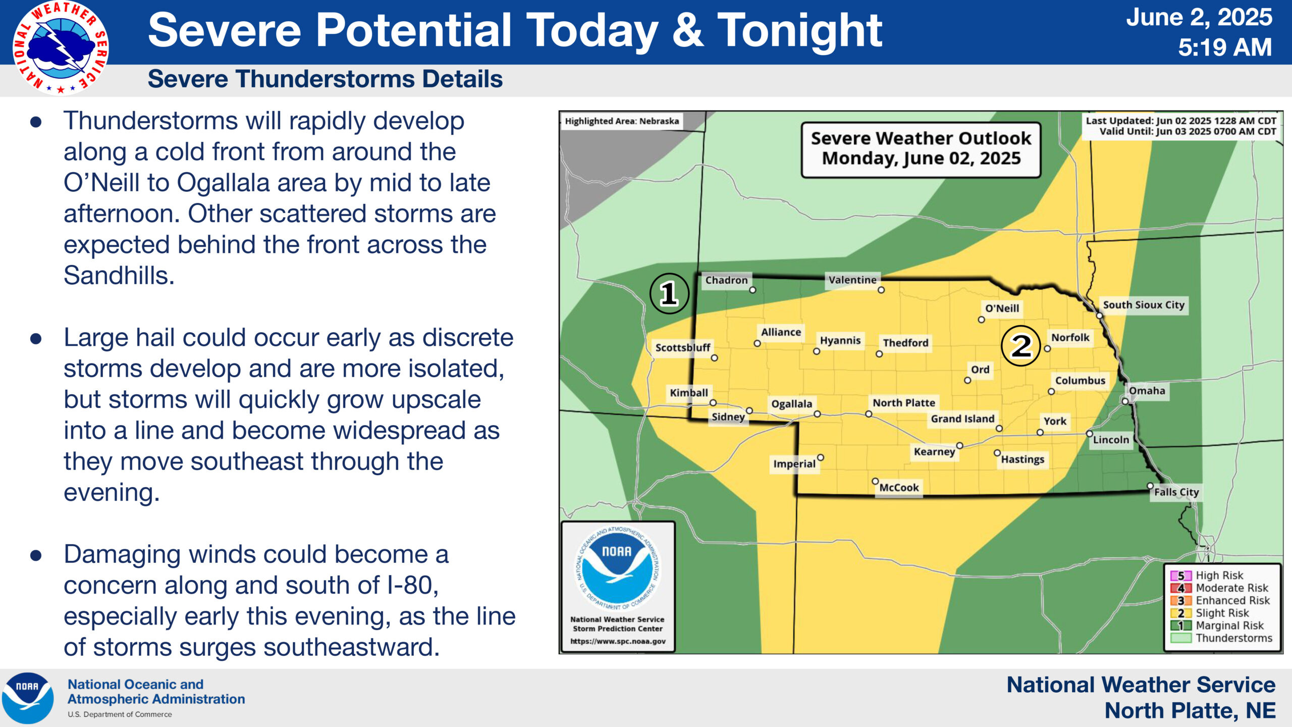
NWS says that thunderstorms will rapidly develop along a cold front from around the O’Neill to Ogallala area by mid to late afternoon. Other scattered storms are expected behind the front across the Sandhills.
While large hail and damaging wind gusts are the primary severe weather concerns, a brief tornado or two cannot be ruled out, NWS said.
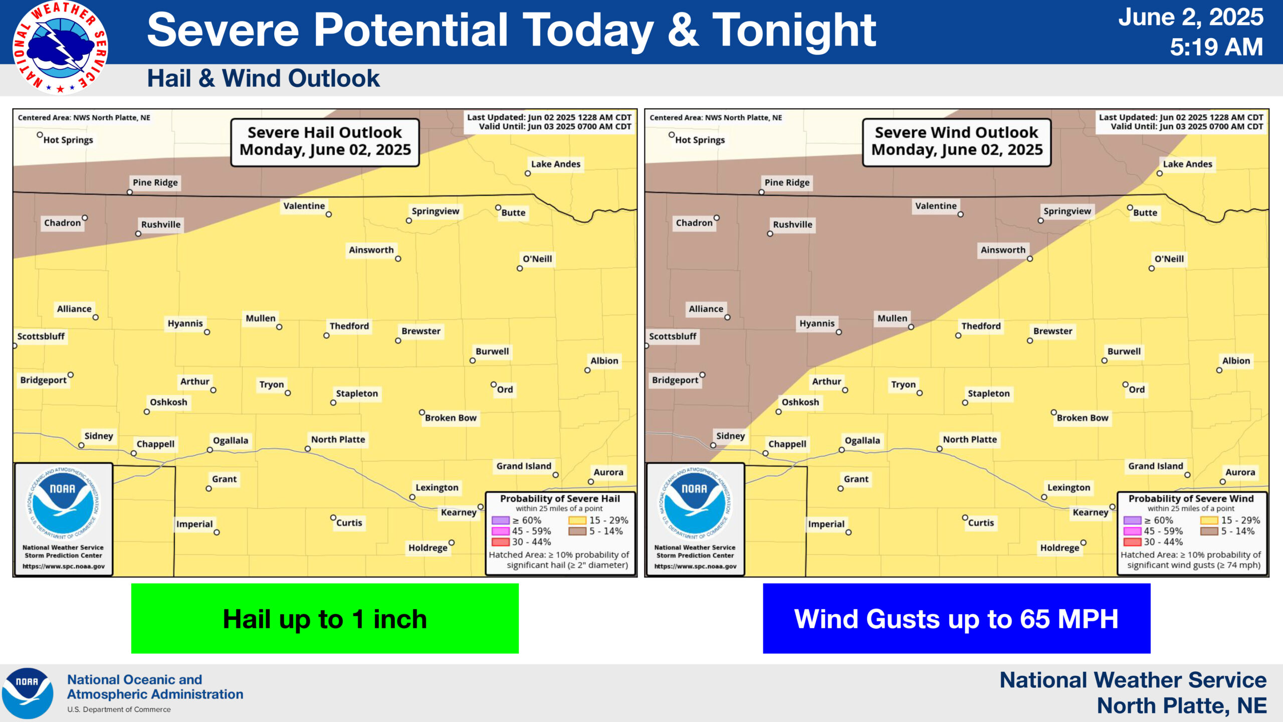
Hail possibilities up to 1 inch in size are at a 15 to 29 percent chance for a large portion of the state, with that same percent chance for wind gusts up to 65 MPH.
Scattered flash flooding due to excessive rainfall is a slight risk as a result of the storms as well. Rainfall amounts could exceed 2.5 inches, especially across portions of central Nebraska.
View the full severe weather packet from the NWS here: Monday, June 2 storm packet