


The National Weather Service has shared snowfall and storm observations following the recent snow storm across the state.
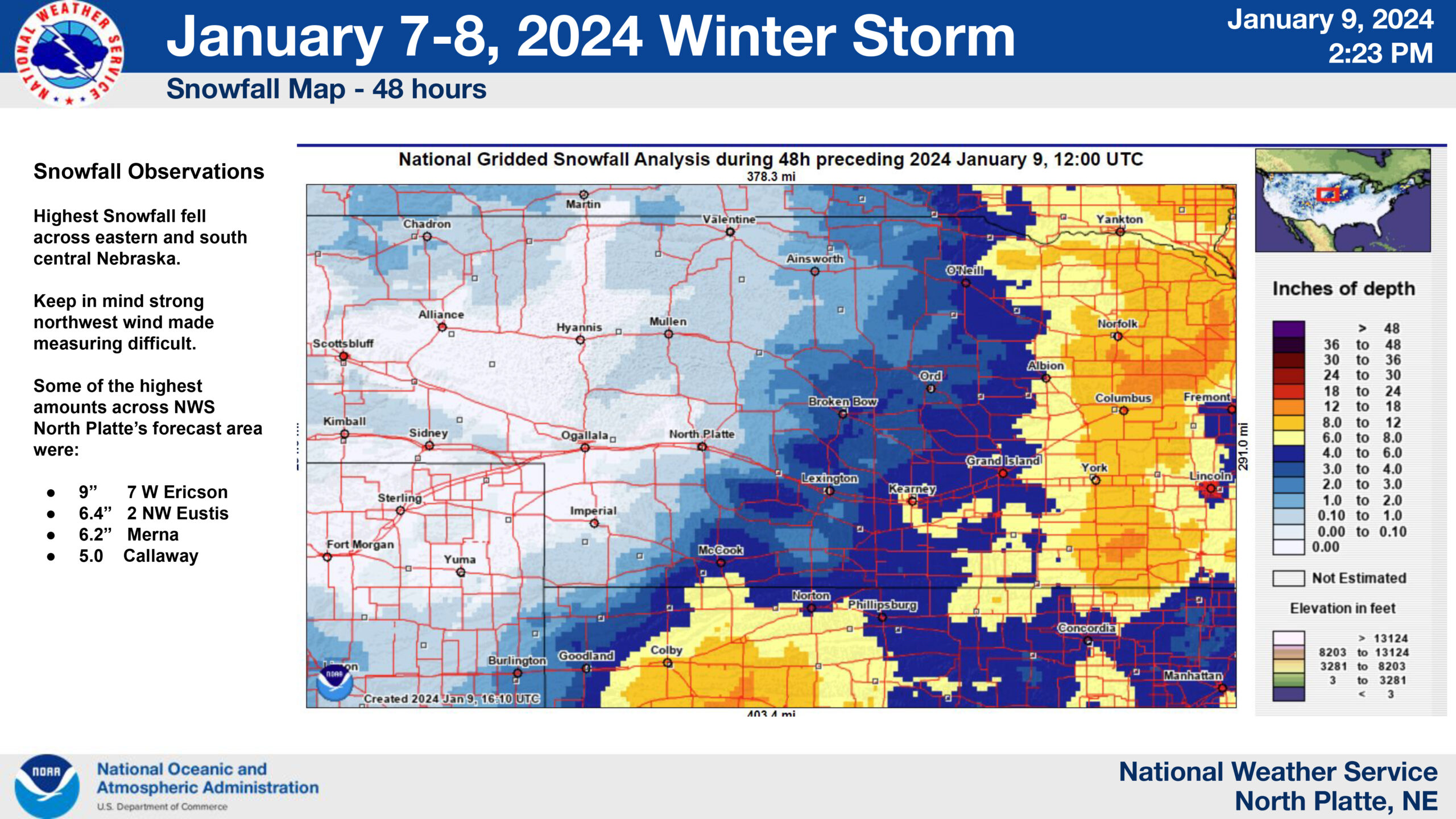
Highest snowfall totals were recorded across eastern and south central Nebraska, although the KCNI/KBBN listening area also received its fair share of powder. Some of the highest amounts of snowfall in the North Platte forecast area, taking into account the difficulty in measuring due to a strong northwest wind, were 9 inches seven miles west of Ericson, 6.4 inches two miles northwest of Eustis, 6.2 inches in Merna, and 5 inches in Callaway.
Statewide, the top snowfall number was recorded four miles west northwest of Daykin where the ruler showed 14.5 inches. In Pawnee county, 13.5 inches were measured four miles southeast of Lewiston by a trained spotter.
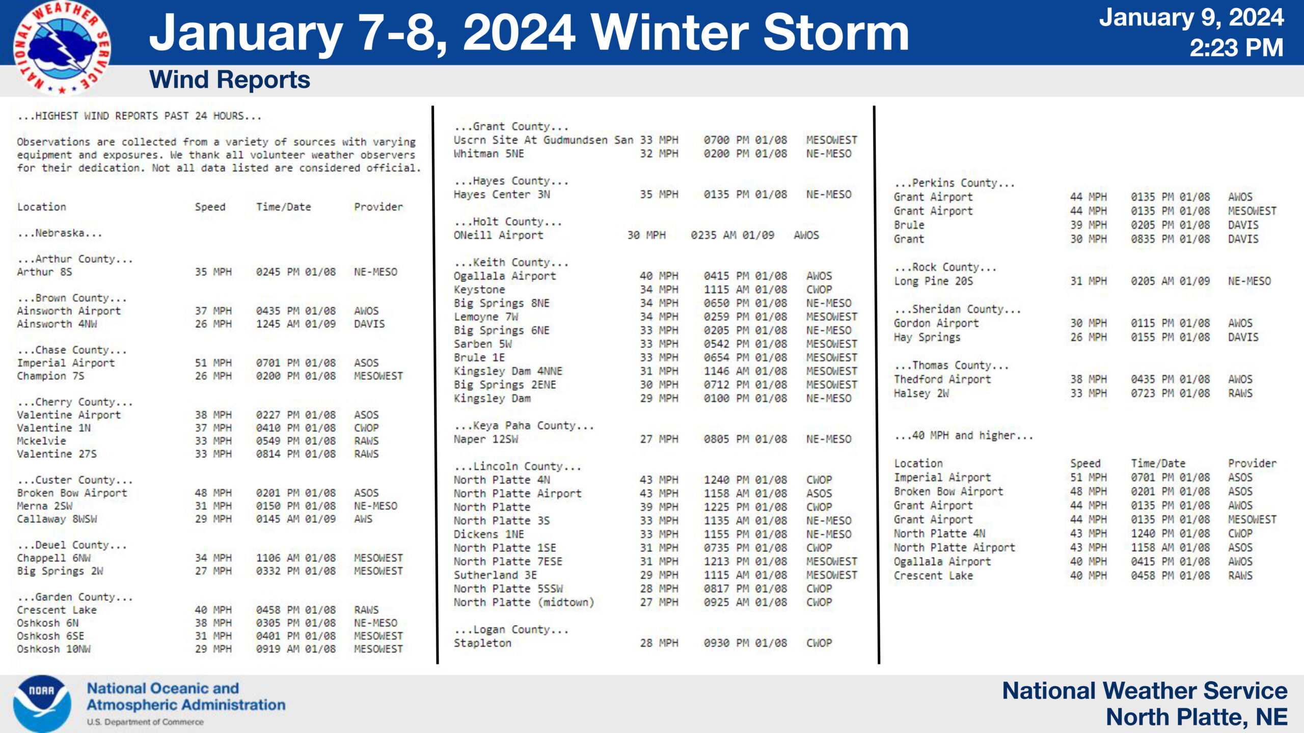
Wind reports from the storm were also a part of the National Weather Service report for the area. The Broken Bow Airport brought in the second highest wind speed of the report at 48 miles per hour. The Imperial Airport observation took the crown for the highest wind speed at 51 miles per hour.