


A strong early spring storm system will arrive Tuesday night and bring strong winds, snow, light freezing precipitation, and cold temperatures through Wednesday.
Temperatures will primarily favor snow, but a period of light freezing drizzle or a wintry mix may be possible. Wind gusts of 45 to 55 mph from the northwest are possible with this storm.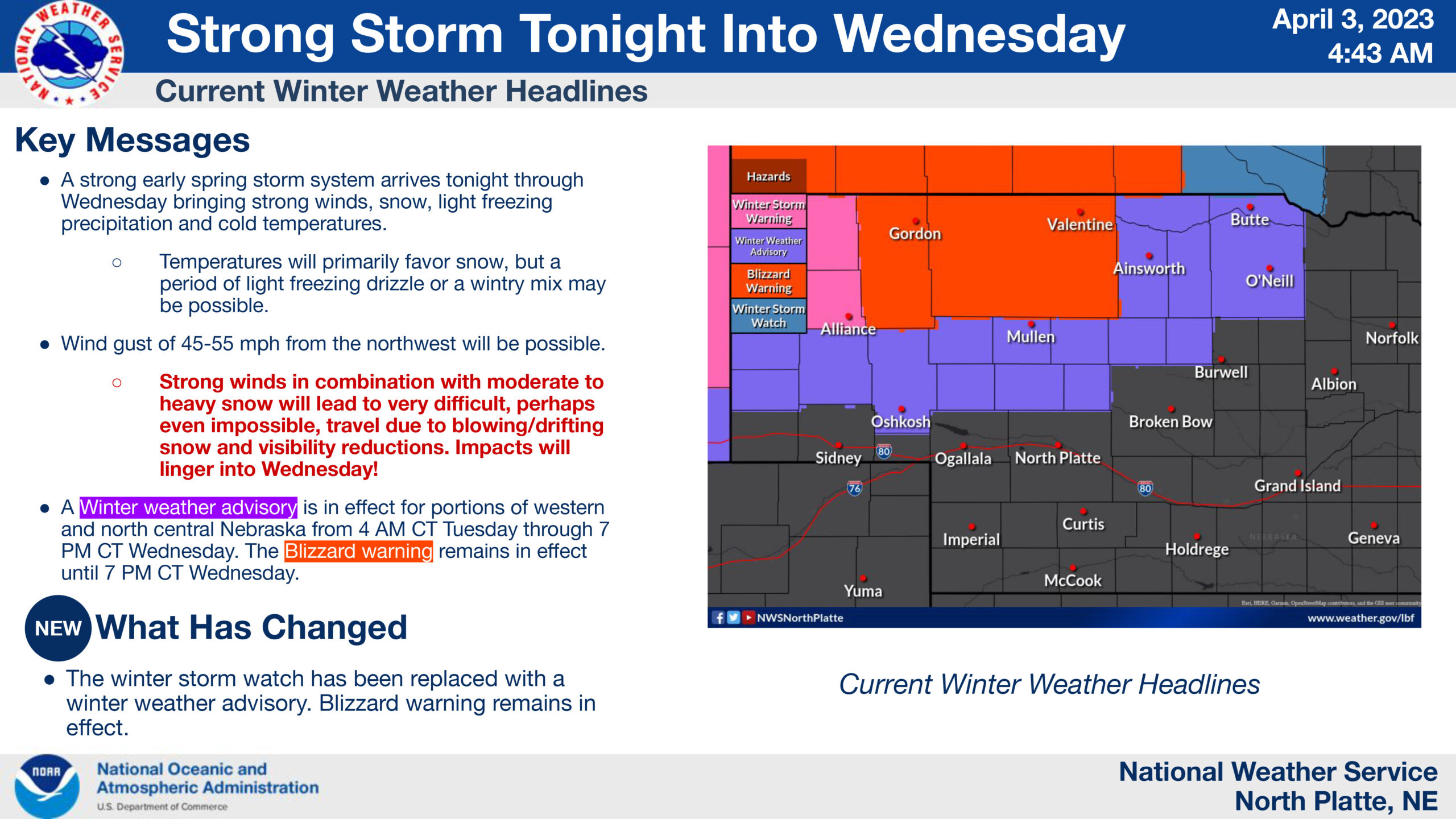
A winter weather advisory is in effect for portions of western and north central Nebraska from 4 AM CT Tuesday through 7 PM CT Wednesday. A blizzard warning remains in effect until 7 PM CT Wednesday.
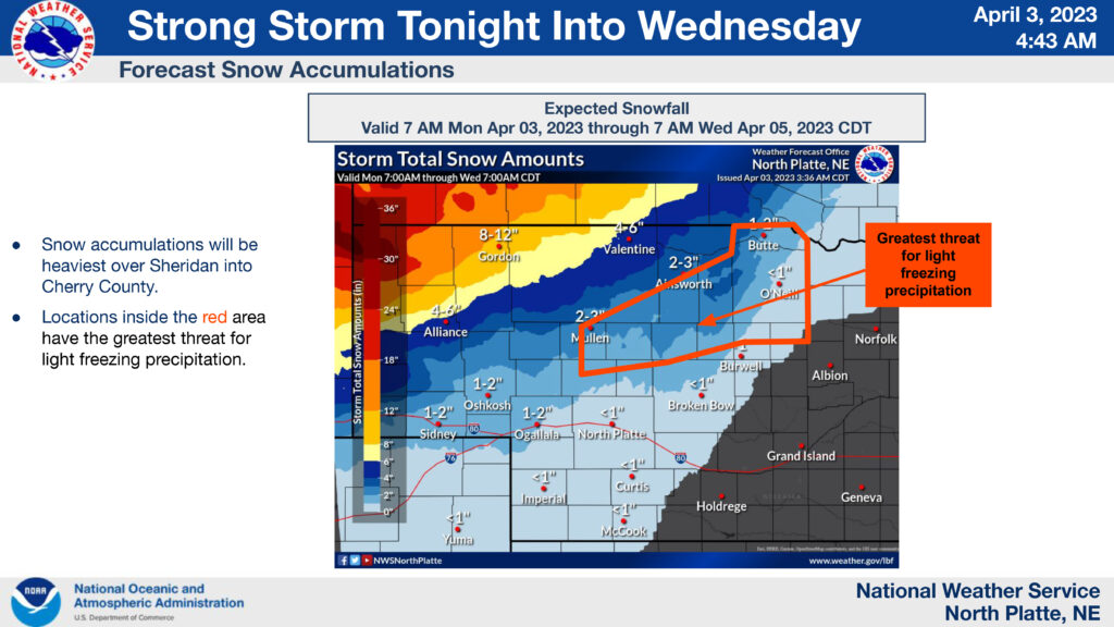
Regarding snow accumulations, Sheridan into Cherry County are expected to see the heaviest amounts. Less snow is expected moving south and east, tapering off to a prediction of less than one inch accumulation for Custer County.