


Another extraordinary storm is expected to slam Nebraska this week, piling on misery and possibly more flooding, and maybe making its way into the record books.
“It looks like it’s going to be a doozy,” said Jeff Weber, an atmospheric scientist at the National Center for Atmospheric Research in Boulder, Colorado. “Nebraska doesn’t need any more moisture right now, and this is going to be a fairly wet system.”
Blizzard conditions, rain, strong winds and perhaps even damaging hail are in the mix.
Whether flooding might occur and where is yet to be seen.
“A lot depends upon where the heaviest rain comes down, but river flooding and flash flooding are possible,” said Scott Dergan, a meteorologist with the National Weather Service. The good news is that the ground is no longer frozen and rivers aren’t iced over, he said.
All that runoff will be washing into an already high Missouri River, he said.
“This isn’t going to be a one-and-done thing,” he said. “We’re going to have to deal with snowmelt and water filtering through the Missouri River system for the next month or so.”
The storm is shaping up to be the second rare bomb cyclone to hit the state in as many months.
Dave Bowers, senior meteorologist with AccuWeather Inc., The World-Herald’s weather consultant, said computer models peg the storm as being on the cusp of meeting the definition of a bomb cyclone.
“It’s going to be close enough,” Bowers said. “The point is you’re looking at a major, major storm.”
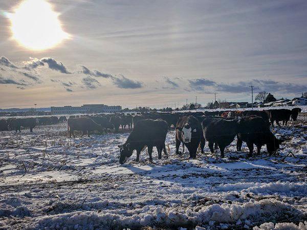
Last month’s bomb cyclone brought a historic blizzard to western Nebraska and dropped several inches of rain on top of heavy snow cover in eastern Nebraska. The blizzard and the flooding from ice jams and rain-snow melt have resulted in two-thirds of the state’s counties being declared federal disaster areas.
The worst of this storm is expected to target some of the areas most affected by last month’s storm, notably western and northern Nebraska, Bowers said. It’s possible that the storm could drop close to 1 to 2 feet of snow along the Nebraska-South Dakota border, and winds could reach 50 to 70 mph, according to Bowers and Weber. The combined water content of the rain and snow in northern Nebraska could translate into 3 to 5 inches of precipitation, Bowers said.
Southeast Nebraska is likely to receive less rain, snow and wind, but could be in the bull’s-eye for severe thunderstorms and hail, according to the weather service. Snowfall totals in the Omaha area have been forecast at 1 to 3 inches, and the water equivalent of the rain-snow mix targeting Omaha could be a half-inch to 1 inch or so, said Accuweather’s Bowers.
The storm arrives as rain Tuesday evening in western Nebraska and shifts to snow from Wednesday into Thursday. The worst of the winds are forecast for Thursday.
The possible bomb cyclone itself won’t develop until the system crosses the Rocky Mountains, Weber said, and for that reason, meteorologists ask that people monitor forecasts to get the latest and most accurate information.
Greg Carbin, forecast branch chief for the National Weather Service’s Weather Storm Prediction Center, said that while rare, repeat patterns for severe weather are known to occur.
“We had a bit of a break in the bad weather ,” Carbin said. “But now it’s back again, with a vengeance.”
Missouri River remains in a flood warning
A flood warning continues for the Missouri River:
- At Plattsmouth affecting Mills and Cass Counties A
- At Nebraska City affecting Fremont and Otoe Counties
- At Brownville affecting Atchison and Nemaha Counties
- At Rulo affecting Holt and Richardson Counties
At 8 p.m. Monday, the river stage at Nebraska City was 19 feet, or a foot above flood stage. Minor flooding is occurring and continues to be in the forecast. The river will continue rising to near 20.5 feet by early Saturday morning. Additional rises may be possible thereafter.
Though flooding is already ongoing, flooding starts to create more of an impact at 20 feet, especially to agricultural areas.
Do not drive cars through areas where water covers the road. The water depth may be too great to allow your vehicle to pass safely. Turn around, don’t drown!
STORM CLOSINGS AND CANCELLATIONS
ROAD CONDITIONS