


The National Weather Service in North Platte indicated Wednesday morning that the confidence in accumulating snow for much of central Nebraska has increased. Winter Storm Watches and Winter Weather Advisories have been issued for much of the KCNI/KBBN listening area.
UPDATE: 4:04 PM Wednesday, March 15th: Winter storm warnings have been added to several counties in our listening area (see map below).
A strong cold front is expected to arrive late tonight into early Thursday, bringing strong winds and increasing precipitation chances. Precipitation arrives late Wednesday,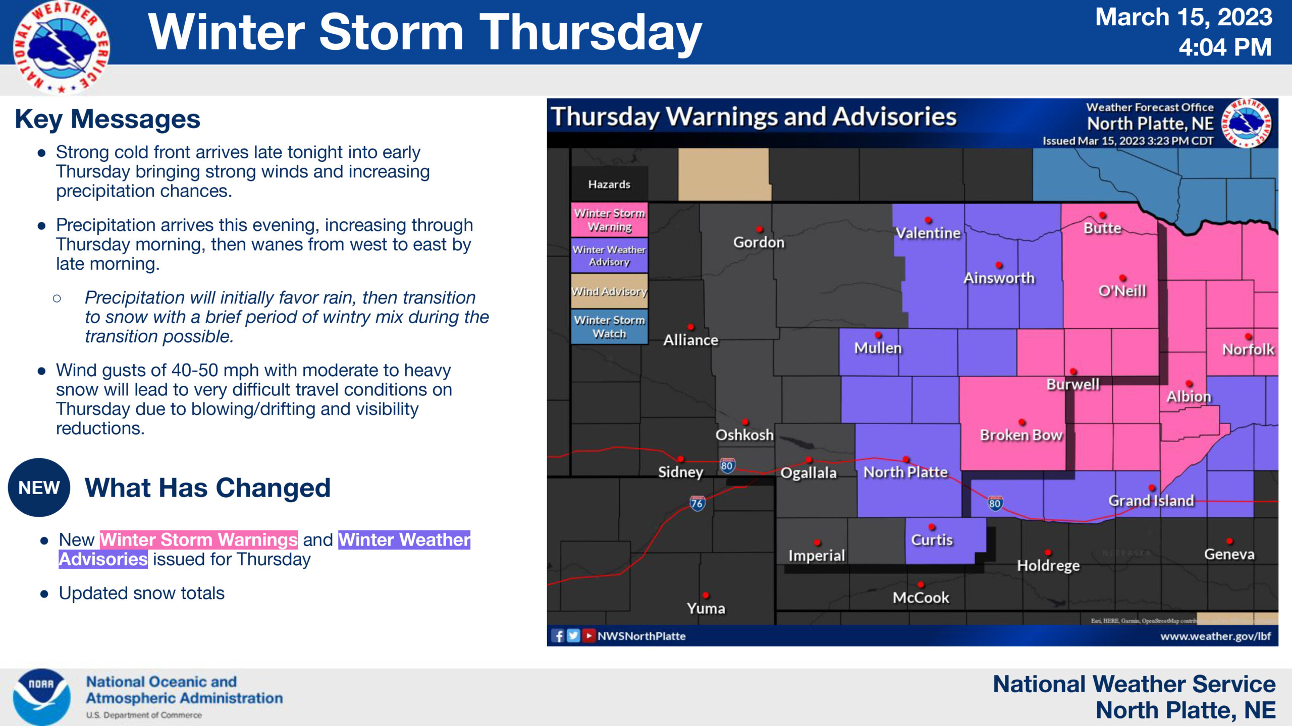 increasing through Thursday morning, before waning from west to east through the afternoon. As far as precipitation type, rain is favored initially before transitioning to snow with a brief period of light freezing rain during said transition.
Wind gusts of 40-50 mph with moderate to heavy snow will lead to very difficult travel conditions on Thursday due to blowing/drifting and visibility reductions.
Heaviest snowfall intensities are unlikely to last longer than 1 to 2 hours at any one location.