


A winter storm is expected to impact the area Tuesday night through Thursday morning, with significant snow accumulation, strong winds, and dangerously cold temperatures.
According to the National Weather Service office in North Platte, snow will develop in the wake of a strong cold front late Tuesday before intensifying on Wednesday and tapering early Thursday.
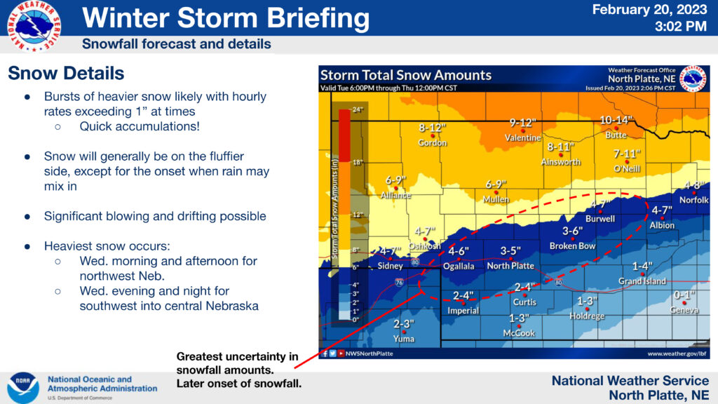
Regarding snowfall, bursts of heavier snow are likely with hourly rates exceeding 1″ at times. Heaviest snowfall is expected to occur Wednesday morning and afternoon for northwest Nebraska and Wednesday evening and night for southwest into central Nebraska.
Winter storm watches and warnings are issued for much of the KCNI/KBBN listening area Tuesday night through Thursday morning.