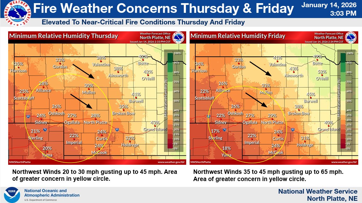


The National Weather Service (NWS) is expecting strong winds over the next couple of days in central and western Nebraska, paired with low humidity levels resulting in elevated to near-critical fire conditions to round out the week on Thursday and Friday.
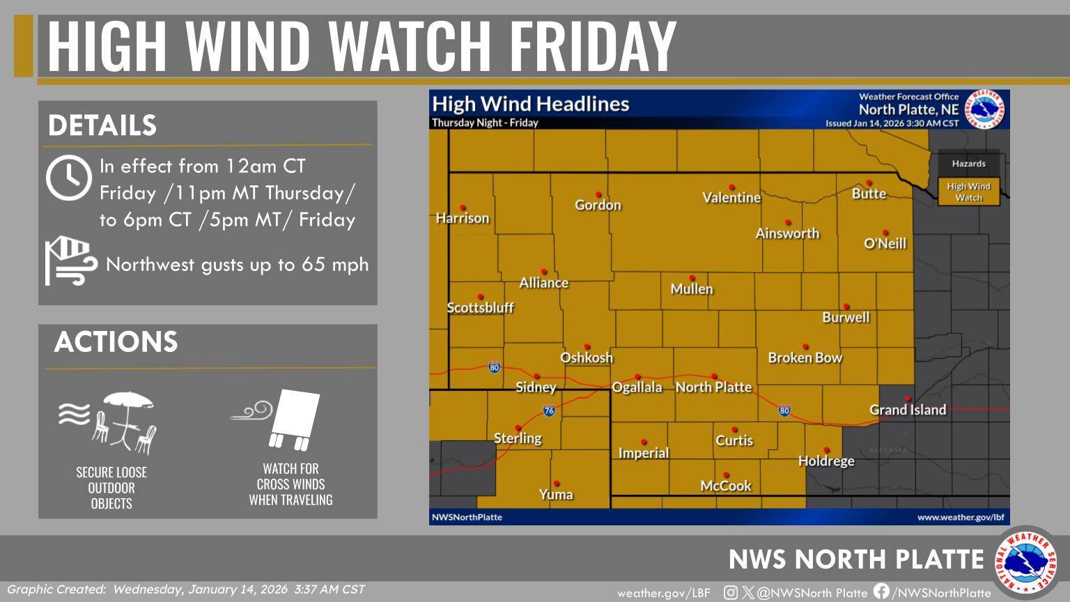
Thursday’s strong winds are expected to gust up to 45 MPH with the strongest winds in the afternoon. Friday’s winds are expected to be moving the fastest, up to 65 MPH and potentially higher. As a result, a high wind watch is in effect from 12 AM to 6 PM CT Friday.
NWS says that travel may be difficult especially in high profile vehicles, encourages securing loose objects, and to be prepared for potential power outages.
Minimum relative humidity levels on Thursday and Friday will dip into the mid to low 20’s for the panhandle and southwest Nebraska, while much of central and north central Nebraska is expected to see a range between the 30s and 40s.
There is also medium confidence in snow showers across portions of north central Nebraska on Friday afternoon, although any snow amounts are expected to remain light and generally less than 1 inch.