


NORTH PLATTE – The National Oceanic and Atmospheric Administration (NOAA) and National Weather Service (NWS) have issued a release reminding the state’s residents that this week, March 27 through 31, is Nebraska Severe Weather Awareness Week, with Tuesday’s focus on severe weather terminology.
Watches and warnings are often confused terms when it comes to severe weather, and mistaking the two could be profoundly dangerous. The NOAA and National Weather Service, in a release, remind Nebraskans of the difference.
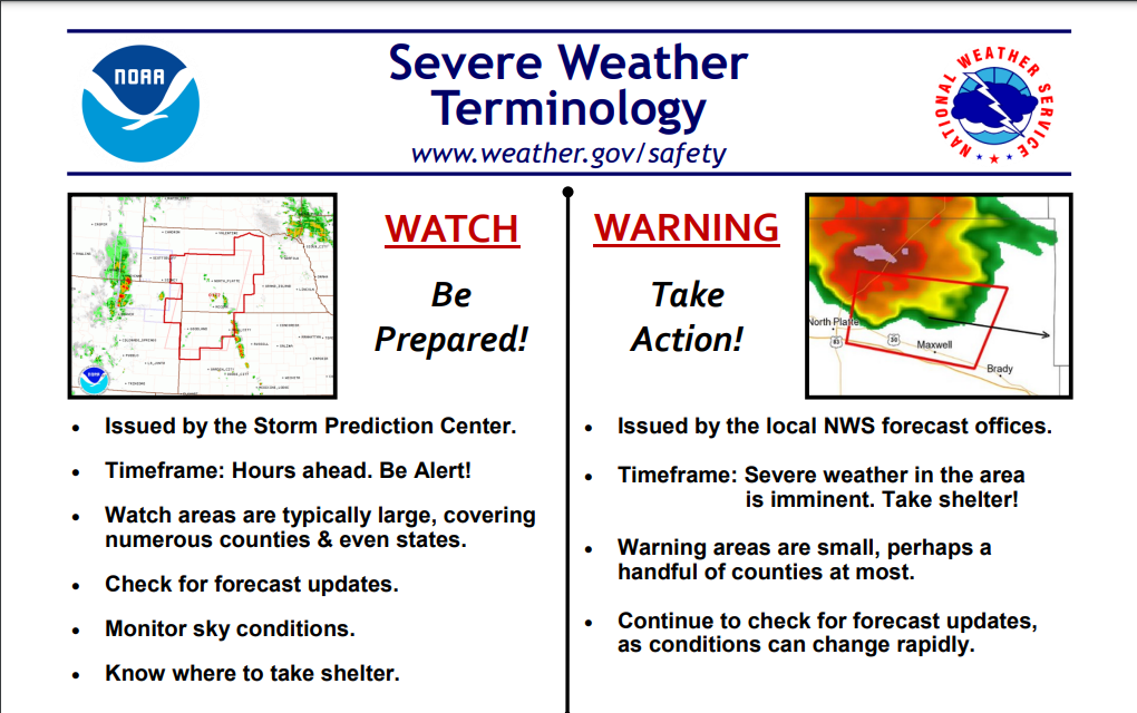
A severe weather watch, according to the organizations, is a period for residents to be vigilant of conditions that may get worse; it is usually issued by the Storm Prediction Center and comes hours ahead of potentially dangerous weather. A severe weather watch also tends to span a larger area than its more dangerous colleague, covering multiple counties and possibly states.
A severe weather warning, on the other hand, is a time for residents to take action and get to safety. The warning is issued by local National Weather Service forecast offices and deals with an imminent timeframe. Warnings, unlike watches, are small areas, at most dealing with a handful of counties. Residents are encouraged, during severe weather warnings, to continually check for updates regarding the weather, as conditions could easily deteriorate further, or improve rapidly.
As part of highlighting severe weather terminology, the NOAA and National Weather Service also highlight what constitutes severity across a variety of familiar phenomena.
A thunderstorm becomes severe when it produces hail an inch or larger, winds of 58 miles per hour or higher, and/or a tornado. A funnel cloud, while similar to a tornado, is still a violently rotating column of air, but unlike its big brother, it does not make contact with the ground. A tornado, on the other hand, has made contact with the ground.
KCNI/KBBN will be highlighting the NOAA and NWS’ chosen topic each day this week, with tomorrow’s focusing further on tornados.