


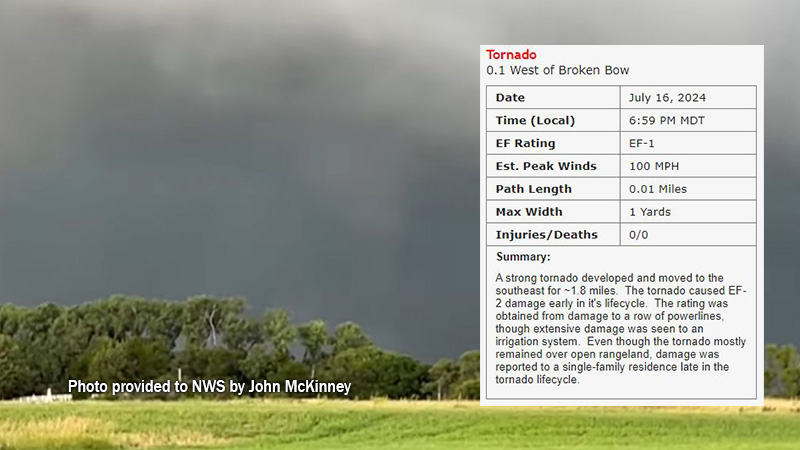
A damage and storm survey has been completed regarding Tuesday evening’s storms in Custer County, according to the National Weather Service (NWS) office in North Platte. A brief tornado on the far western edge of the City of Broken Bow was a part of the report.
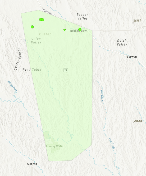
According to the report, completed with collaboration from the Custer County Emergency Management Office, storms became severe quickly with widespread wind and hail damage from Brown and Rock Counties and through the entirety of Custer County.
The tornado information in the survey says it was observed on the far western edge of Broken Bow, where it came in contact with the ground for less than two seconds. However, in that time, it was able to throw an 800 pound trailer into an adjacent car. The tornado was observed by a storm spotter and surveillance cameras. An EF-2 rating was given to the tornado due to the damage it caused.
NWS says several downbursts stripped crops to stubble while also toppling trees, snapping power poles, and destroying irrigation pivots. The NWS defines a downburst as powerful winds that descent from a thunderstorm and spread out quickly once they hit the ground. They can easily cause damage similar to that of an EF0 or even EF1 tornado, and sometimes misinterpreted as tornadoes.
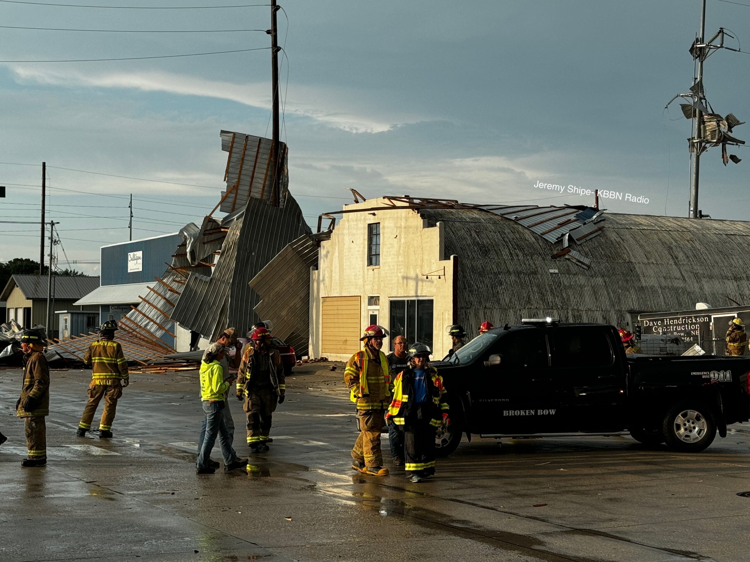
One downburst in particular, which impacted the Culligan building in Broken Bow, caused the roof to detach and be thrown into adjacent buildings as well as high tension power lines.
The overview stated the heaviest concentration of outflow wind was from just south of Merna across Broken Bow to Pressey Wildlife Management Area. In that area, wind speeds ranged from 60 to 95 MPH.
A storm that swept through Custer County, NE this evening claimed the roof of a building in Broken Bow near the intersection of South 5th Ave. and C Street. Pieces of the roof could be seen wrapped around a nearby power pole #NEwx pic.twitter.com/aAHqfdq0VD
— Jeremy Shipe (@JeremyOnTheMic) July 17, 2024