


STEELE CITY – Another round of severe thunderstorms made their way through north central Kansas and southeast Nebraska on Tuesday afternoon and evening.
While the tornado threat diminished as the evening progressed, very large hail was reported in several locations, especially in Jefferson County.
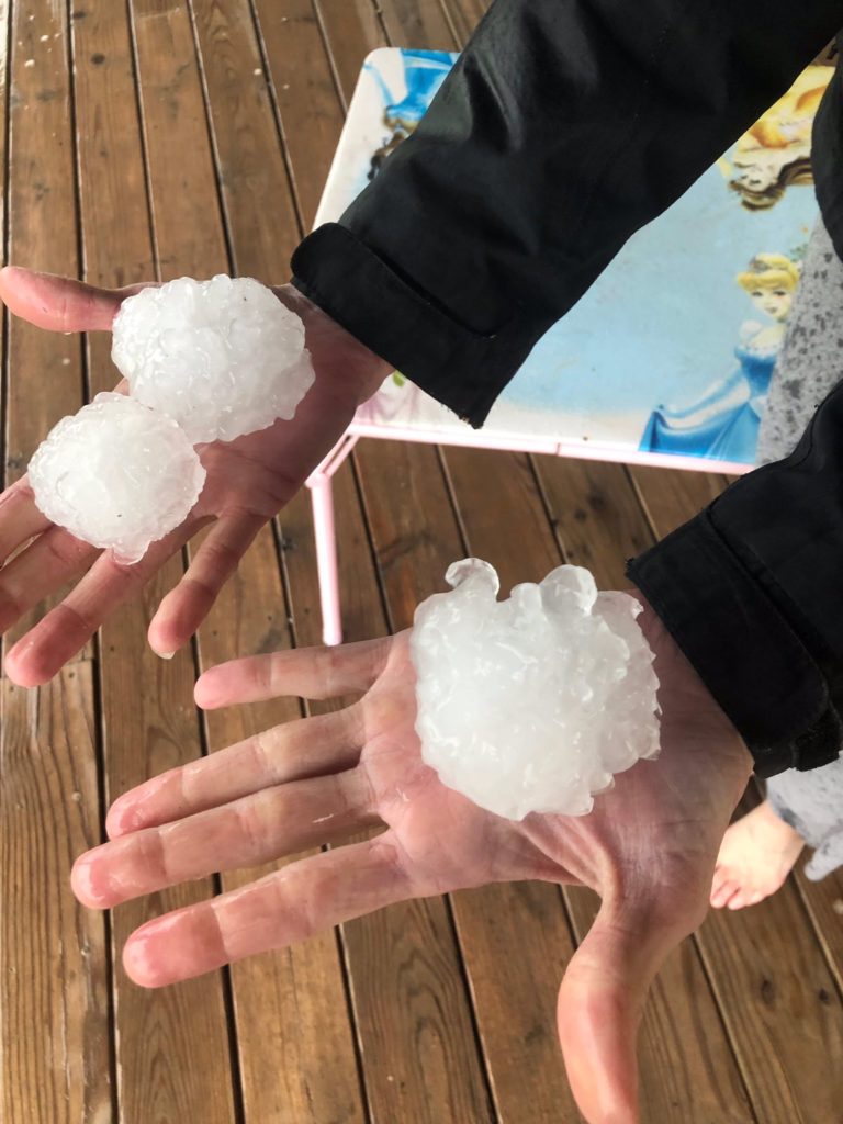
The largest reports of hail came from Odell and Steele City, where storm spotters and emergency management reported tennis-ball sized hail between 7:55-8:25 p.m.
There were also reports of egg-sized hail near Endicott, and baseball-sized hail near Hollenberg, KS. Ping-pong ball-sized hail was also spotted near Norway, KS.
Elsewhere, funnel clouds were reported near Scandia and four miles southwest of Belleville, but there were no confirmed touchdowns in these areas.
There was, however, several reports of confirmed tornadoes in Osborne County, KS with some structure damage reported near Tipton.
There was also heavy tornado damage reported further east in the Lawrence area, where it’s estimated an EF3 touched down just west of Kansas City.
Heavy rain
Flash flooding continues to be an issue across southeast Nebraska, especially toward the Missouri River valley. Richardson County received anywhere from 2-7 inches of rain over the last couple of days.
The National Weather Service reported 20 rural roads in Richardson County underwater, with reports of cars flooded in the Humboldt and Falls City areas.
Elsewhere, Flood Warnings remain in place along the Big Blue and Little Blue Rivers, and the Turkey Creek near Wilber.
You can follow Tommy on Twitter @Tommy_NCN.