


An extended period of dangerously cold conditions will affect much of western and north central Nebraska into early next week. High temperatures will remain in the single digits the next couple days, then struggle to even reach zero across the Sandhills over the weekend. Low temperatures will approach record levels, while wind chill values will routinely drop lower than 20 below zero.
* WHAT…Very cold wind chills expected. Values will be near 20 below zero through Friday morning, then possibly drop to 30 below zero or colder Saturday, Sunday and Monday mornings.
* WHERE….All of western and north central Nebraska.
* WHEN…Until noon CST /11 AM MST/ Monday.
* IMPACTS…The dangerously cold wind chills could cause frostbite on exposed skin in as little as 10 minutes.
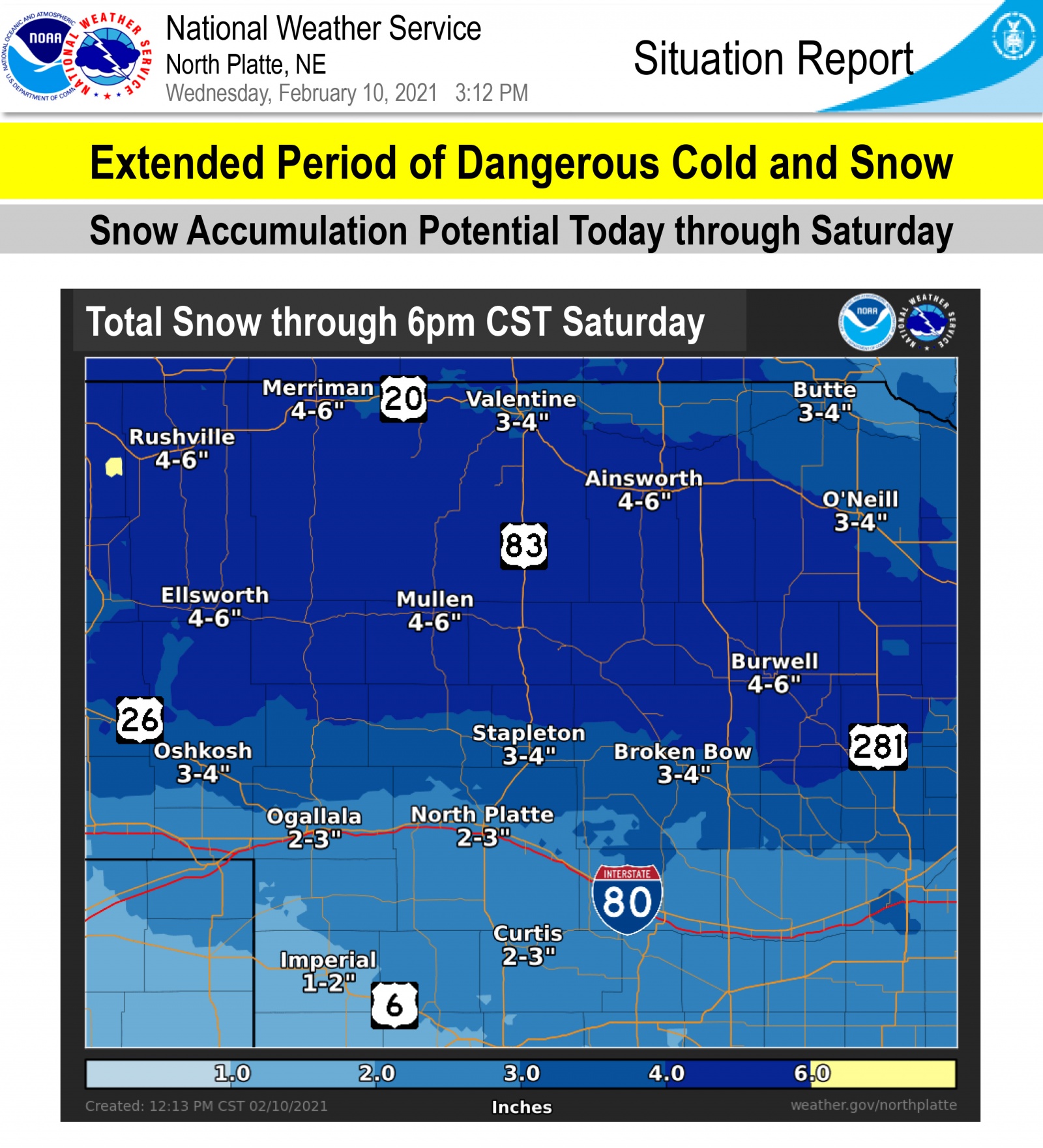
* ADDITIONAL DETAILS…Significant snowfall is also expected Friday and Friday night with the greatest potential across the northern and central Sandhills.
PRECAUTIONARY/PREPAREDNESS ACTIONS…Use caution while traveling outside. Wear appropriate clothing, a hat, and gloves.